

Fold Friday: Field Photos
Fold Friday: Field Photos
A brief trip down memory lane of some of my university field trips.

Fold Friday this week is going to look a little different. This post will be free to all subscribers.
I had a family emergency come up suddenly and wasn’t able to do my regular research and writing for this series. For that, I am sorry. I am hoping I am able to get my regular Tuesday articles back on track over the weekend, but I’m a bit uncertain how the next few days will play out. Give your loved ones an extra hug today and tell them you love them.
At this point, I want to still share a few things with you all, just in a little different fashion. Thank you for your support, and continued interest in Earth Science.
This week, I will share a handful of photos of places I’ve been through my education as a geoscientist. I was fortunate to take part in several extensive field projects and travel to some awesome spots for mapping, sample analyses, and geologic characterizations.
The following set of images shows a few of the places I have been able to travel to and a short description of each site or what I did while I was there.
Thanks for reminiscing with me, and I look forward to another normal Fold Friday next weekend. Thank you again for your support, I can’t thank you all enough for being a part of this series and for following my work.
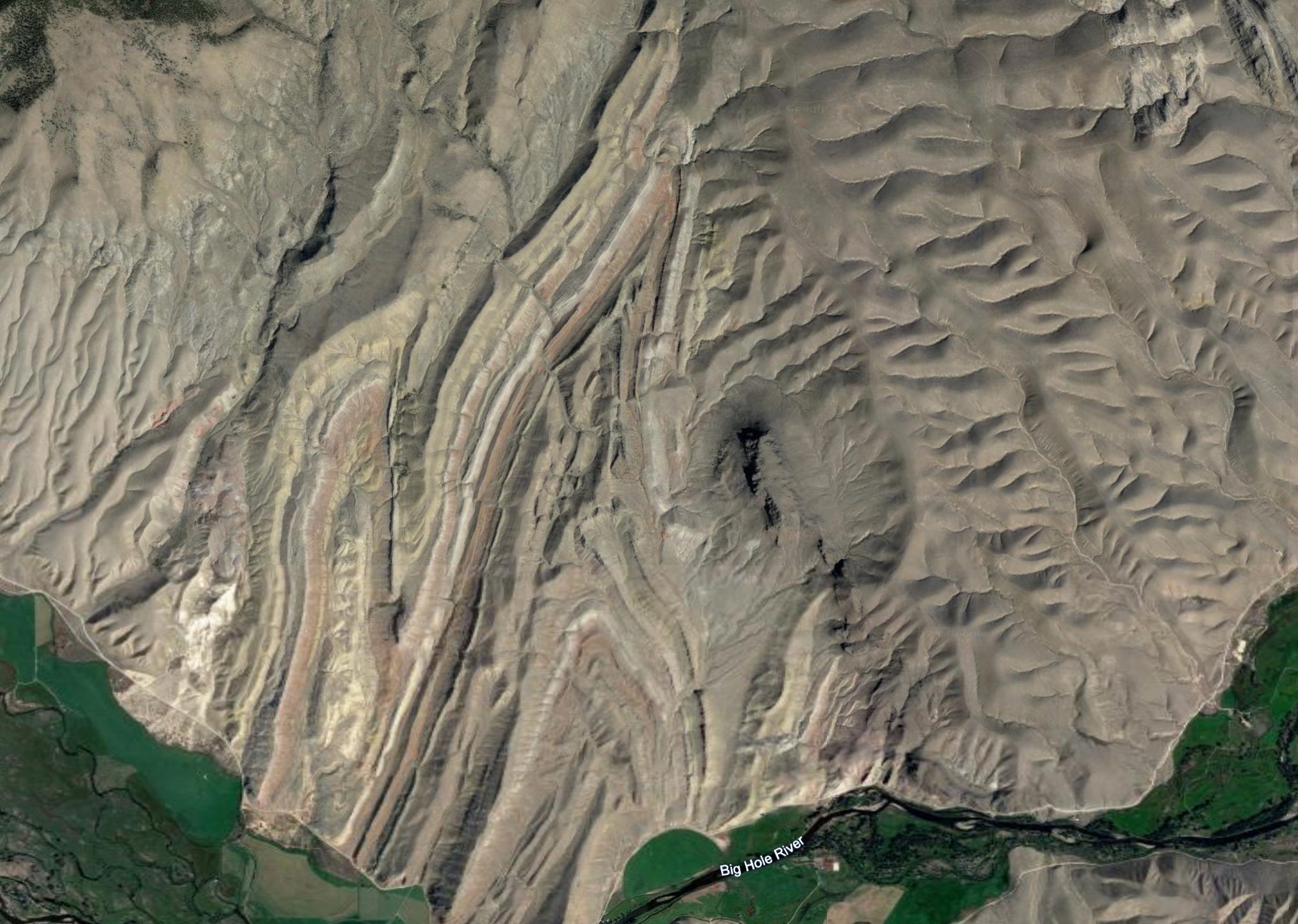
Sandy Hollow, MT
Sandy Hollow was a place I spent a week mapping, along with the rest of my geology field camp class.
Sandy Hallow consists of layers of limestone, dolomite, sandstone, and shale that have been tilted into an archway and eroded. The resulting structure is called an “anticline". Also as part of this region is a “syncline”, the opposite of an anticline (an upside down arch), and a thrust fault.

Long Valley Caldera
Long Valley in California is one of the few supervolcanoes in the world: the largest classification of volcanoes. The caldera (the depression in Earth’s crust left behind after a volcanic eruption) at Long Valley measures 16 x 32 km (20 x 10 mi) in diameter.
Long valley erupted 760,000 years ago, and the resulting volcanic ash and debris formed what is called the “Bishop Tuff”. A tuff is a specific geologic deposit made of volcanic ash, glass, and debris.
Long Valley is still considered an active volcanic system, and categorized “Very High” threat potential based on the National Volcano Early Warning System.
I was part of a week long trip to map parts of the Bishop Tuff, and other various deposits and volcanoes as part of the Long Valley system.

San Francisco Volcanic Field
I was fortunate to go to graduate school in Flagstaff, Arizona, near some fabulous terrain to study geology. Directly north of town is the San Francisco volcanic field: a region containing nearly 600 volcanoes.
Two of the volcanoes we specifically visited were Strawberry Crater and SP Crater.
Strawberry and SP craters both had multiple stages of eruption. Strawberry was more popcorn-like eruption of basaltic magma, with splattered beads of lava that spit from the opening to form the volcano sides and rocks called “scoria” and “cinder”.


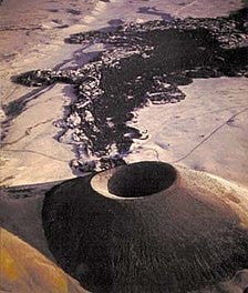
SP crater also sits in the San Francisco Volcanic Field and is composed of basaltic rocks.
SP crater was used at one point by NASA astronauts to train for a Moon landing.
Perhaps a folk tale from the past, but an interesting origin story, SP crater was (maybe??) named by an early farmer and landowner of SP crater, who said the mountain looked like a knocked-over shit-pot (SP). If you looked close enough at a satellite image, you just might agree.

What a wonderful opportunity to study in Flagstaff. We were fortunate to stumble upon Sunset Crater after visiting Grand Canyon NP a few years ago. Stunning.